CoreSpatial Portal, built on the powerful MapStore2 framework, is designed to be your all-in-one solution for managing geospatial content. Whether you need to create interactive maps, detailed dashboards, or compelling GeoStories, CoreSpatial Portal provides the tools and flexibility to bring your data to life.
Contact [email protected] to Learn More
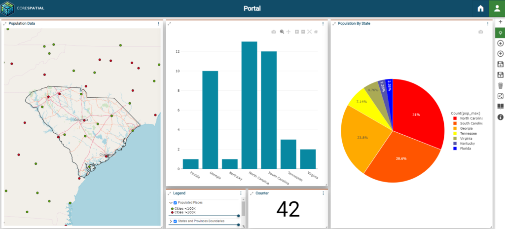
Visualize Your World with CoreSpatial Portal

Share and Collaborate with CoreSpatial Portal
CoreSpatial Portal to Analyze with Precision
Tell Your GeoStory with CoreSpatial Portal
Robust Functionality
CoreSpatial Portal makes it easy to create and explore maps that reveal the insights hidden within your data. With a user-friendly interface and robust visualization tools, you can layer multiple datasets, customize your map views, and highlight the information that matters most to you.
Reveals Actionable Insights
Turn data into actionable insights with CoreSpatial Portal’s advanced analytical capabilities. The platform allows you to perform complex geospatial analyses directly within your maps and dashboards, providing you with the information you need to make informed decisions.
Enabling Effective Collaboration
Geospatial insights are most powerful when shared. CoreSpatial Portal enables you to easily share your maps, dashboards, and GeoStories with colleagues, stakeholders, and the public. Whether you’re presenting a strategic plan, coordinating a response effort, or educating your community, CoreSpatial Portal’s sharing features make collaboration simple and effective.
Learn more about the CoreSpatial products that power Portal under the hood