Meet the Lineup
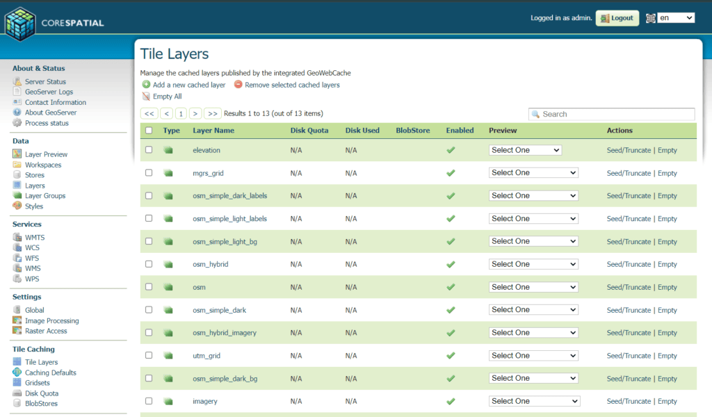
CoreSpatial Server
Easily host all of your geospatial data in one single location. If security is a concern, it won’t be with CoreSpatial. Our solution is hardened for any cyber compliance on any network.
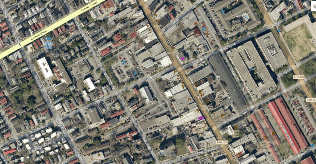
CoreSpatial Basemaps and Map Manager
You don’t have to be a GIS expert to create high resolution imagery layers with CoreSpatial Map Manager. Simply drag and drop your imagery and CoreSpatial Map Manager handles the rest.
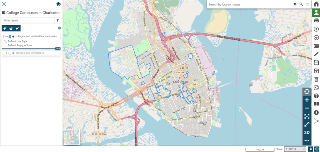
CoreSpatial HIFLD
Knowing where our critical infrastructure is located is one thing, but putting it on the map with other operational data will give you the insights you need to make risk reduction decisions.
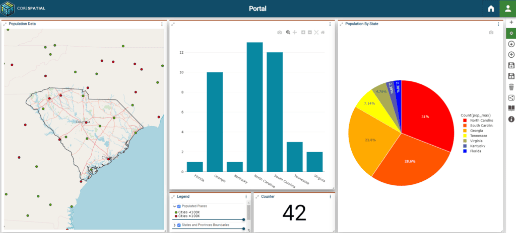
CoreSpatial Portal
Maps are great to have, but the analysis of those maps is even better. CoreSpatial Portal can enable any level of user to reach decisions faster and more efficiently.
Contact Us
Let’s discuss how CoreSpatial can accelerate your enterprise geospatial project or augment existing solutions
Technical Specs
Technical Specifications
- Engineered Excellence: CoreSpatial® features a hardened, optimized version of GeoServer designed for secure, scalable, and high-performance geospatial operations.
- Proactive Security: Incorporates critical vulnerability updates from CISA.gov, with active mitigations and scheduled updates enhancing security.
- DISA Compliance: Adheres to DISA.gov best practices, including regular vulnerability scanning and updates, ensuring optimal security posture.
- Performance Optimization: Fine-tunes the Java Virtual Machine for peak performance and efficient memory usage.
- Reliable and Compliant: Continual product enhancements and strict adherence to OGC standards ensure CoreSpatial’s operational reliability and seamless interoperability for integrated geospatial analysis.
Use Case
- Versatile Applications: CoreSpatial excels in a variety of uses, from app development to strategic defense and disaster response.
- Defense and Strategy: Defense agencies rely on CoreSpatial® for superior data integration and analysis, boosting situational awareness and decision precision.
- Disaster Response: Emergency services use CoreSpatial’s real-time visualization for quick, effective strategies during natural disasters, significantly improving response outcomes.
- Mobile and Cloud-Ready: With packaging for both mobile servers and public clouds, CoreSpatial offers a versatile, anywhere-access solution, suitable for all scenarios.
Integration and Customization
- Adaptive Integration: CoreSpatial is designed for adaptability, seamlessly integrating into existing IT landscapes and offering extensive customization to meet each client’s specific operational needs.
- Effortless Connectivity: Its superior integration capabilities ensure effortless connectivity with a wide range of geospatial and enterprise systems, enhancing data collaboration and utility.
- Modular Design: CoreSpatial’s modular design allows clients to select functionalities that best fit their workflows, with support from NGS’s custom development services for further customization.
- Custom Extensions: NGS crafts unique plugins, modules, and interfaces to tackle specific challenges, delivering solutions that exceed client expectations.
Support and Maintenance
- Comprehensive Support: NGS’s commitment extends beyond CoreSpatial deployment, providing a robust support and maintenance framework to ensure ongoing client success.
- Expert Access: Clients have direct access to our expert team for technical support, troubleshooting, and operational advice, ensuring swift resolution of any issues.
- Empowering Training: Tailored training programs enable users to fully harness CoreSpatial’s capabilities, enhancing their geospatial proficiency and effectiveness.
- Continuous Improvement: NGS regularly updates CoreSpatial with security enhancements, new features, and performance upgrades to maintain its cutting-edge status.