Overview
Client: USSOCOM – Automated Information Discovery Environment (AIDE). Subcontractor to Novetta Solutions (and Accenture Federal Services via acquisition in 2021).
Time frame: 2014 – 2024
NGS implemented core geospatial services for AIDE, delivering a standards-based, deployable stack that provided enterprise basemaps, geospatial search, high-resolution imagery collection and mosaicing, and flexible OGC publishing. The platform enabled commanders and analysts to visualize a broad range of DoD data in 2D and 3D, interoperate with legacy mission systems, and operate across multiple classified domains without vendor lock.
Enterprise Geospatial Operating Picture (2D View)
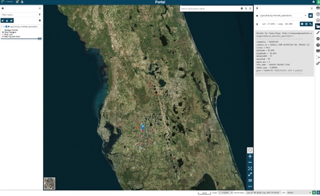
AIDE provides a unified 2D geospatial operating picture supporting enterprise-wide situational awareness.
Challenge
AIDE’s mission required solving several hard problems simultaneously:
- Delivering a single, consistent, high-resolution basemap that could be updated routinely with new commercial and tactical imagery and distributed reliably across disconnected or bandwidth-constrained enclaves.
- Providing fast, accurate geospatial search (gazetteer, coordinate parsing, MGRS/UTM support) to let non-GIS users find places and coordinates with military formats.
- Ingesting, validating, and mosaicing imagery from multiple providers and enabling on-demand collects without overwhelming limited networks.
- Publishing a wide variety of vector and raster data from across DoD systems using open, interoperable interfaces (WMS/WFS/WMTS/vector tiles/etc.) so many clients — including legacy C2 systems — could consume the same authoritative services.
- Visualizing combined multi-source data in both 2D and 3D (OpenLayers + CesiumJS) while preserving performance, styling parity, and consistent layer semantics between views.
Solution (Core Geospatial Services)
Basemaps and Vector/Raster Tile Strategy
NGS built AIDE’s basemaps on an extensible OSGeo foundation. GeoServer served raster imagery and vector tile basemaps (MapBox/MBStyle support) so the same basemap content could be consumed as raster tiles for legacy clients or as styled vector tiles for modern web clients. This approach reduced bandwidth for clients that could render vector tiles and kept styling consistent across OpenLayers and CesiumJS views. GeoServer’s existing vt/vector-tile support and the MBStyle workflow were key enablers.
Gazetteer / Geospatial Search
NGS provided a Gazetteer service (OSM + GeoNames + custom uploads) that supported name lookup, reverse geocoding, and coordinate parsing (MGRS, UTM, DMS). The Gazetteer fed many AIDE applications, enabling non-specialist users to perform precise searches and to drop correctly formatted coordinates into mission workflows. The service was designed to be extensible so customer CSVs or mission lists could be uploaded and indexed.
Operational Overlay Example: Gazetteer overlays via GeoServer WFS
The Gazetteer service enables rapid name-based and coordinate-based discovery, supporting mission workflows with military-formatted search.
High-Resolution Imagery Collection & Mosaicing (Gambit)
Gambit — an NGS imagery acquisition and QA application — provided imagery discovery, preview/QA, and automated acquisition from commercial providers via OGC-friendly interfaces. Once a collect was approved, Gambit patched imagery into a global, high-resolution mosaic managed inside GeoServer so new pixels became immediately available to all AIDE clients. Gambit also implemented a “hub-and-spoke” replication model and bandwidth controls to allow regional nodes to share imagery without saturating links. These capabilities enabled frequent, localized updates while maintaining a single authoritative mosaic for the enterprise.
GeoServer and OGC Interoperability
GeoServer was the central publishing layer. NGS leveraged GeoServer’s OGC interfaces (WMS for rendered maps, WFS for feature access, WMTS/vector tiles for tiled delivery, WCS where raster coverage access was needed, and time/dimension support) to expose a wide range of products and metadata. The flexibility of GeoServer allowed NGS to add fields, time dimensions, and custom layer attributes required by downstream DoD consumers and to harden access controls for cross-domain use. Practical extensions — e.g., vector tiles, MBStyle support, and WFS filtering enhancements — were applied where they improved usability and performance.
Operational Overlay Example: MGRS Grid via GeoServer WMS
Operational overlays such as MGRS grids are dynamically delivered via OGC services to support tactical planning and coordination.
The flexibility of GeoServer allowed NGS to add fields, time dimensions, and custom layer attributes required by downstream DoD consumers and to harden access controls for cross-domain use. Practical extensions — e.g., vector tiles, MBStyle support, and WFS filtering enhancements — were applied where they improved usability and performance.
OGC-Compliant Service Configuration (WMS/WFS/WMTS via GeoServer)

GeoServer-backed OGC services ensure standards-based interoperability across enterprise and legacy mission systems.
2D and 3D Visualization (OpenLayers + CesiumJS)
AIDE clients used OpenLayers for high-performance 2D mapping and CesiumJS for immersive 3D visualization.
3D Terrain Visualization with Cesium Integration
CesiumJS enables immersive 3D terrain visualization while preserving styling parity and layer consistency with the 2D environment.
GeoServer-published vector tiles and raster tiles were consumed by both clients; NGS implemented parity in styling so the same basemap and tactical layers appeared consistent whether viewed in 2D or 3D. The stack also allowed seamless transitions between OpenLayers and Cesium, preserving layer order, symbology, and time-enabled animations for temporal products.
Integration with Legacy DoD Systems
To achieve enterprise interoperability, NGS integrated AIDE geospatial services with legacy DoD systems and message buses. Examples include:
- DDS / ABCS / DCGS-A: A data broker and DDS integration enabled discovery and subscription to ABCS family advertisements and DCGS-A products, exposing relevant geospatial products into AIDE layers.
- FADE / MIST: GeoServer WFS layers were adapted to satisfy FADE/MIST consumers; NGS addressed session and filtering edge cases to ensure stable production integrations.
- TAK and other C2 tools: GeoServer products and the Gazetteer were consumable by TAK and similar clients through standard OGC services or simple export adapters, allowing tracks, geofences, and overlays to flow into operator tools used in the field.
Implementation & Verification
NGS used an iterative, experiment-and-refine process: prototype tile and mosaic strategies, validate hub-and-spoke replication in constrained links, and load-test GeoServer under realistic multi-domain loads. Each imagery feed and connector ran through staged QA; Gambit’s QA workflow ensured only approved collects were patched into the mosaic. Security hardening, containerized deployments, and replication safeguards (dbrep / audit) supported multi-domain operations and traceability.
Outcomes
- Authoritative, updateable basemap. A single high-resolution mosaic that could be updated centrally and efficiently replicated to forward nodes. Gambit’s hub-and-spoke and bandwidth controls preserved operational connectivity.
- Fast, reliable search and coordinate handling. The Gazetteer service reduced user errors and sped mission workflows with military coordinate formats.
- Standards-based interoperability. GeoServer’s OGC services allowed AIDE to publish the same authoritative layers to a wide set of consumers — C2 tools, DCGS, FADE/MIST, and TAK — eliminating silos and enabling cross-program correlation.
- Consistent 2D/3D experience. OpenLayers and CesiumJS front ends presented the same basemap and tactical layers with parity in styling and temporal behaviors, improving analyst trust and situational understanding.
Conclusion
AIDE’s geospatial core — built on GeoServer, PostGIS, Gambit, and modern web clients — demonstrates how an open, standards-based stack can deliver mission-grade basemaps, fast geospatial search, reliable high-resolution imagery mosaics, and broad interoperability across legacy DoD systems. The approach reduced vendor risk, supported constrained networks through intelligent replication, and delivered a consistent 2D/3D operational picture used by tactical and analytical consumers alike. NGS’s work on AIDE proves that carefully engineered open-source geospatial services can meet the demanding needs of modern DoD operational environments.