
Expanding capabilities, advancing geospatial solutions
From custom development to DevSecOps and C5ISR integration, NGS delivers the full lifecycle of secure, interoperable geospatial engineering.
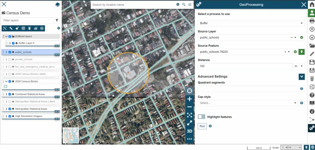
Core capability areas
Agile Software Development
Iterative, SCRUM-based delivery aligned to mission requirements.
DevSecOps Delivery
Security embedded across the lifecycle with automated CI/CD pipelines.
Geospatial Data Integration
Diverse data sources unified for accurate, interoperable analysis.
3D Geospatial Visualization
Self-hosted streaming 3D and 3D Tiles from your own imagery, via CoreSpatial 3D.
Cloud Enablement & Optimization
Cloud-native, containerized architectures tuned for scale and cost.
AI-Accelerated Development
Machine learning and automation to raise quality and speed delivery.
C5ISR Systems Integration
Integration with mission systems and tactical data standards.
Open Standards & Interoperability
OGC- and DoD-compliant, vendor-neutral, extensible systems.
Capability documents
Get the NGS capability statement and capabilities brief, everything acquisition teams need on our people, past performance, codes, and contract vehicles.
NGS Capability Statement
One-page overview of core competencies, differentiators, NAICS codes, and company data.
Download PDFNGS Capabilities Brief
Detailed brief covering our services, CoreSpatial platform, and representative past performance.
Download PDFCoreSpatial Slick Sheet
Product overview of the CoreSpatial platform and its modules for government and enterprise GIS.
Download PDFCoreSpatial 3D
Self-hosted streaming 3D and 3D Tiles from your own data, built into CoreSpatial Portal.
Explore CoreSpatial 3D
How we engage
Custom Development NAICS 541511 / 541512
Bespoke geospatial solutions tailored to each client's challenges, from extending existing systems to designing new applications. We start by understanding your objectives, then build solutions aligned to your strategic goals.
Consulting & Implementation NAICS 541690 / 541990
End-to-end support from needs assessment and system design through deployment and integration. We shape strategies to fit your requirements and stand up CoreSpatial or a custom solution to meet them.
Training & Support NAICS 541519
Comprehensive training and ongoing support that continue past deployment. Programs are tailored to your team, from new users to experts, and our support team keeps operations running once you're live.
Data Integration & Management NAICS 541330 / 541990
Integration and management across diverse data sources, so information flows reliably between systems and platforms. The result is interoperability that improves the accuracy and utility of your geospatial analysis and decision-making.
Applicable NAICS codes: 541511, 541512, 541519, 541690, 513210, 541330, 541370, 541990.
Tell us about your requirement
Share a bit about your program and we'll follow up with how our capabilities fit.
Want to see CoreSpatial Server live?
Our demo environment gives you a real look at the platform, OGC services, map layers, and all.
Request a Demo